Bassenthwaite, Cumberland Family History Guide
Bassenthwaite is an Ancient Parish in the county of Cumberland.
Other places in the parish include: Low-side, High-side, and Hawes.
Alternative names:
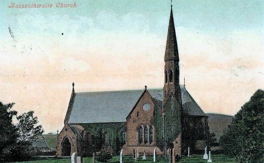
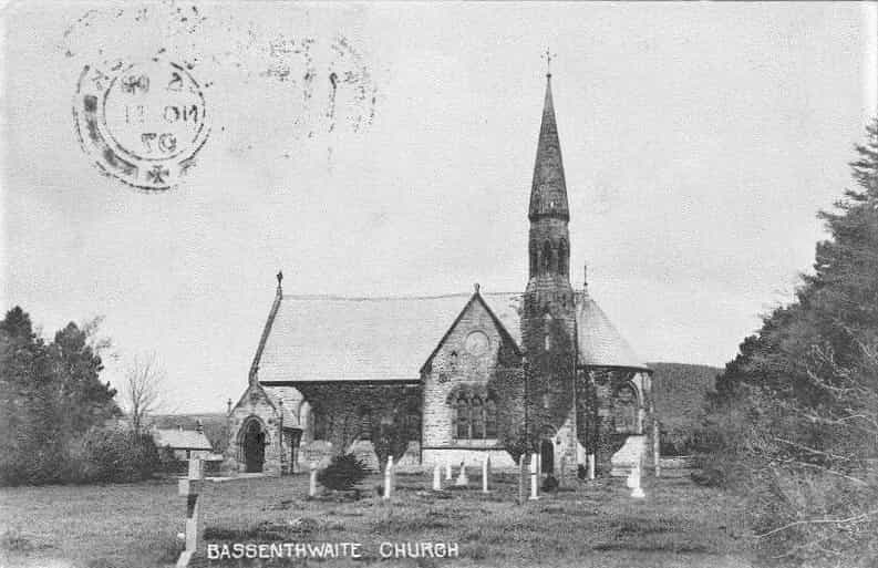
Parish church: St Bega
Parish registers begin:
- Parish registers: 1574
- Bishop’s Transcripts: 1664
Nonconformists include: Wesleyan Methodist
Table of Contents
Adjacent Parishes
Parish History


The Imperial Gazetteer of England & Wales 1870
BASSENTHWAITE, a village, a parish, and a lake in Cockermouth district, Cumberland. The village stands on the E side of the lake, opposite Bassenthwaite L. r. station, 5 miles NNW of Keswick; and has a post office under Windermere.
The parish is divided into two constablewicks, High-side around the village and Low-side or Hawes. Acres, 6,930. Real property, £4,568. Pop., 570. Houses, 120. The property is much subdivided. The surface is highly diversified and picturesque, ranging from the summit of Skiddaw to the meadows on the lake. Lead ore has been found; and a mine of antimony worked. The living is a vicarage in the diocese of Carlisle. Value, £150. Patrons, the Dean and Chapter of Carlisle. The church is old but good; and there are charities £14 and some land.
The lake is in the basin of the Derwent river; commences 3 miles NW of the foot of Derwent water; extends 4½. miles north-north westward, with a mean breadth of ¾ of a mile; and has a surface elevation of 210 feet above the level of the sea. Its bosom is not gemmed with any island; its head is flat and open, but looks away to the mountains round Derwent water; its W side is flanked by a range of wooded fells, mostly rising from the water’s edge; its foot is screened by vale and slope, going up at 3 miles distance to Binsey hill; and its E side is flanked by the grand skirts and shoulders of Skiddaw, crowned, at 2½ miles’ distance, by that mountain’s summit. Pike and perch abound in the lake; and salmon pass through it to the Upper Derwent.
Source: The Imperial Gazetteer of England & Wales [Wilson, John M]. A. Fullarton & Co. N. d. c. [1870-72].
A Topographical Dictionary of England 1848
BASSENTHWAITE (St. Bridget), a parish, in the union of Cockermouth, Allerdale ward below Derwent, W. division of Cumberland, 5 miles (N. W. by N.) from Keswick; containing 536 inhabitants.
The parish comprises about 7000 acres, much of which is wet heavy land; it includes a portion of the lofty mountain Skiddaw, situated at its south-eastern extremity, and is intersected by the river Derwent. The beautiful lake of Bassenthwaite, or Broadwater, covers about 1500 acres, and the parish is enriched throughout with scenery of a sublime character. There is a mine of antimony in the neighbourhood, and lead-ore has also been found. The living is a perpetual curacy; net income, £123; patrons and appropriators, the Dean and Chapter of Carlisle: the tithes were commuted for land in 1770. In addition to the parochial church, there is a chapel of ease.
Source: A Topographical Dictionary of England by Samuel Lewis 1848
Parish Records
FamilySearch
The records listed below are part of the FamilySearch Catalog Collection. The records may be Free to view and/or search online or can be ordered from your Local Family History Library.
Cumberland Historical Directories
Administration
- County: Cumberland
- Civil Registration District: Cockermouth
- Probate Court: Court of the Bishop of Carlisle (Episcopal Consistory)
- Diocese: Carlisle
- Rural Deanery: Allerdale
- Poor Law Union: Cockermouth
- Hundred: Allerdale below Derwent Ward
- Province: York